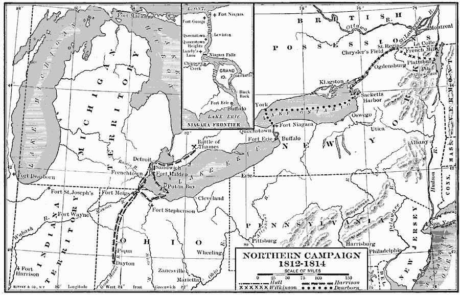
Description: A map of the Great Lakes region of North America showing the area of conflict during the northern campaign of the War of 1812, from Lake Michigan east to Lake Champlain and the Hudson River. The map shows the routes of Hull, Wilkinson, Harrison, and Dearborn, and shows important battle sites and forts. An inset map details the Niagara frontier, including the forts Niagara, George, and Erie, and the battle sites of Queenstown Heights, Chippewa Creek, and Lundy's Lane.
Place Names: A Regional Map of North America, Canada, �United State
ISO Topic Categories: boundaries,
inlandWaters,
location,
oceans
Keywords: Northern Campaign, physical, �political, �historical, physical features, country borders,
major political subdivisions, water routes, boundaries,
inlandWaters,
location,
oceans, 1812–1814
Source: Albert Bushnell Hart, LL.D., The American Nation Vol. 13 (New York, NY: Harper and Brothers, 1906) 88
Map Credit: Courtesy the private collection of Roy Winkelman |
|