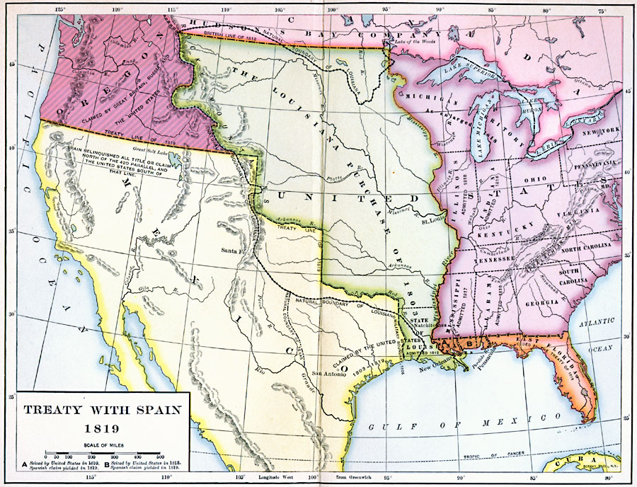
Description: A map of the western United States and northern Mexico showing the territorial disputes settled and boundary established by the Adams–Onís Treaty between the United States and Spain in 1819. The territorial disputes involved the natural boundary of the Louisiana Territory purchased by the United States in 1803 and the Texas Territory claimed by the United States, the territory in the Oregon Country claimed by Great Britain, Spain, and the United States, and the territory in West Florida seized by the United States in 1810 and in 1813 as shown on the map at (A) and (B). The Treaty of 1819 established the boundary on the 42nd Parallel for the southern border of the Oregon Country, the boundary of the Louisiana Territory to the Sabine River, and the ceding of the Florida territories to the United States.
Place Names: Growth of Nation, Louisiana Purchase, �West Florida, �East Florida, �Spanish Territor
ISO Topic Categories: boundaries,
inlandWaters,
location,
oceans
Keywords: Treaty with Spain, physical, �political, physical features, local jurisdictions, boundaries,
inlandWaters,
location,
oceans, 1819
Source: Albert Bushnell Hart, LL.D., The American Nation Vol. 13 (New York, NY: Harper and Brothers, 1906) 272
Map Credit: Courtesy the private collection of Roy Winkelman |
|