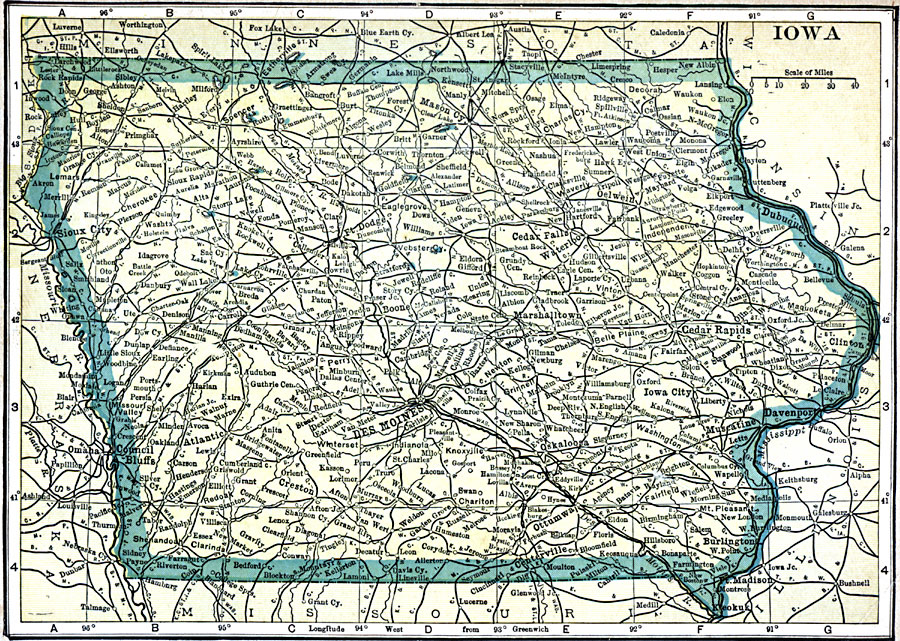
Description: A map from 1909 of Iowa showing the State capital of Des Moines, major cities and towns, railroads, and rivers, including the border rivers of the Mississippi and Missouri.
Place Names: Iowa, Cedar Falls, �Council Bluffs, �Davenport, �Des Moines, �Dubuque, �Iowa, �Ottumwa, �Waterloo,�Clinton, �Iowa City, �Sioux City
ISO Topic Categories: oceans,
location,
inlandWaters
Keywords: Iowa, local jurisdictions, �political, local jurisdictions, oceans,
location,
inlandWaters, Unknown, 1909
Source: C. S. Hammond, Hammond's Handy Atlas of the World (New York, NY: C. S. Hammond & Company, 1911) 45
Map Credit: Courtesy the private collection of Roy Winkelman |
|