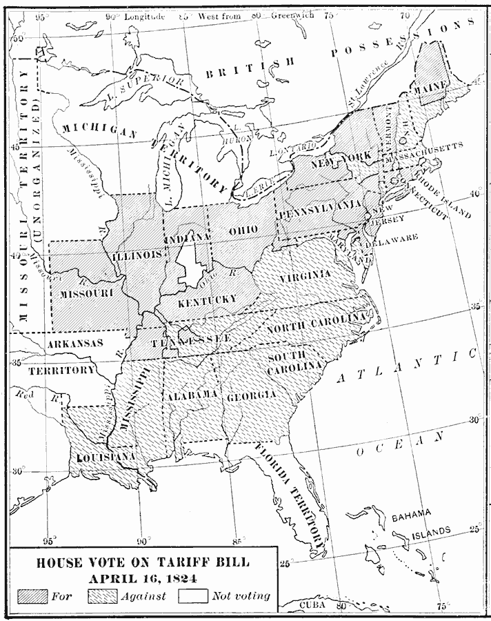
Description: A map of the United States showing the results of the House vote on the Tariff Bill of 1824 during the presidency of James Monroe. The map is keyed to show the areas of votes for, against, or non–votes on the bill. The bill was a protective tariff aimed primarily at British manufactured goods, and the map shows the voting results reflecting the manufacturing sector in the north, who would gain by the tariff, and agricultural sector in the south who would suffer.
Place Names: Elections, House Vot
ISO Topic Categories: boundaries,
inlandWaters,
location,
oceans
Keywords: House Vote on the Tariff Bill, physical, �political, physical features, country borders,
major political subdivisions, boundaries,
inlandWaters,
location,
oceans, Unknown, April 16, 1824
Source: Albert Bushnell Hart, LL.D., The American Nation Vol 14 (New York, NY: Harper and Brothers, 1906) 242
Map Credit: Courtesy the private collection of Roy Winkelman |
|