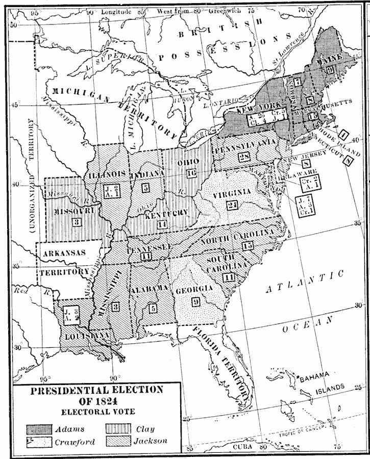
Description: A map of the United States showing the results of the 1824 presidential election. The 1824 election is unusual in that all of the candidates were from the same Democratic–Republican party, and being the only time since the passage of the Twelfth Amendment that the presidential election was decided by the House of Representatives. The map is keyed to show the states carried by John Quincy Adams, Andrew Jackson, William H. Crawford, and Henry Clay. The figures in boxes indicate the number of Electoral Votes for each State.
Place Names: Elections, Presidential Electio
ISO Topic Categories: boundaries,
inlandWaters,
location,
oceans
Keywords: Presidential Election, physical, �political, physical features, country borders,
major political subdivisions, boundaries,
inlandWaters,
location,
oceans, Unknown, 1824
Source: Albert Bushnell Hart, LL.D., The American Nation Vol 14 (New York, NY: Harper and Brothers, 1906) 260
Map Credit: Courtesy the private collection of Roy Winkelman |
|