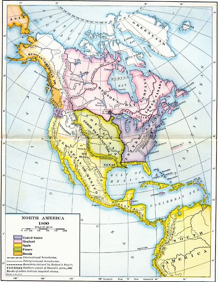
Description: A map of North America and Central America showing territorial claims and possessions in 1800. The map is color–coded to show the territories of the United States, British, Spanish, French, and Russians, and indicates areas of disputed claims in bands of color. The map shows international boundaries, interprovincial boundaries, the boundary claimed by the Hudson Bay Company and the southern extent of the Russian 1821 claim in the west. The map shows the territories of the Russian American Company, Hudson Bay Company, Upper Canada, Lower Canada, New Brunswick, Newfoundland, Nova Scotia, the United States, Louisiana ceded to France (Treaty of San Ildefonso, 1800), New Spain or Mexico, Texas, West Florida, East Florida, Bahamas, West Indies, Belize, and Guatemala extending to the Panama Isthmus.
Place Names: A Regional Map of North America, Asia, �North America, �South Americ
ISO Topic Categories: boundaries,
inlandWaters,
location,
oceans
Keywords: North America, physical, �political, kCentralAmerica, physical features, country borders,
major political subdivisions, boundaries,
inlandWaters,
location,
oceans, Unknown, 1800
Source: Albert Bushnell Hart, LL.D., The American Nation Vol 12 (New York, NY: Harper and Brothers, 1906) 6
Map Credit: Courtesy the private collection of Roy Winkelman |
|
