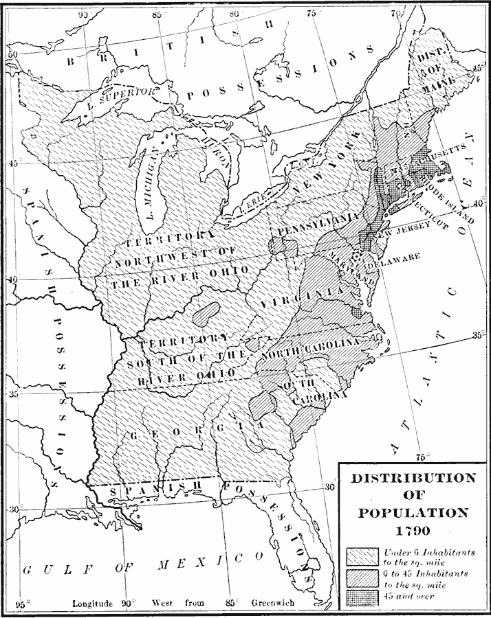
Description: A map of the original thirteen States in 1790 showing State lines, territories northwest and south of the Ohio River, British and Spanish possessions, and the distribution of the European–American population east of the Mississippi River at the time. The map is keyed to show the areas of population density ranging from under 6 inhabitants per square mile to areas with 45 and over inhabitants per square mile.
Place Names: Demographics, populatio
ISO Topic Categories: boundaries,
inlandWaters,
location,
oceans,
society
Keywords: Distribution of Population, physical, �political, �statistical, kPopulation, physical features, country borders,
major political subdivisions, population, boundaries,
inlandWaters,
location,
oceans,
society, Unknown, 1790
Source: Albert Bushnell Hart, LL.D., The American Nation Vol 11 (New York, NY: Harper and Brothers, 1906) 168
Map Credit: Courtesy the private collection of Roy Winkelman |
|