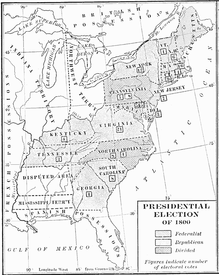
Description: A map of the United States showing the results of the 1800 presidential election, and shows the 16 states, territories, disputed areas, and Spanish Florida. The map is keyed to show the states carried by the Democratic–Republican Party (Thomas Jefferson), the Federalist Party (John Adams), and the states where the vote was divided. The figures in boxes indicate the number of Electoral Votes for each State.
Place Names: Elections, Presidential Electio
ISO Topic Categories: boundaries,
inlandWaters,
location,
oceans
Keywords: Presidential Election, physical, �political, physical features, country borders,
major political subdivisions, boundaries,
inlandWaters,
location,
oceans, Unknown, 1800
Source: Albert Bushnell Hart, LL.D., The American Nation Vol 11 (New York, NY: Harper and Brothers, 1906) 290
Map Credit: Courtesy the private collection of Roy Winkelman |
|