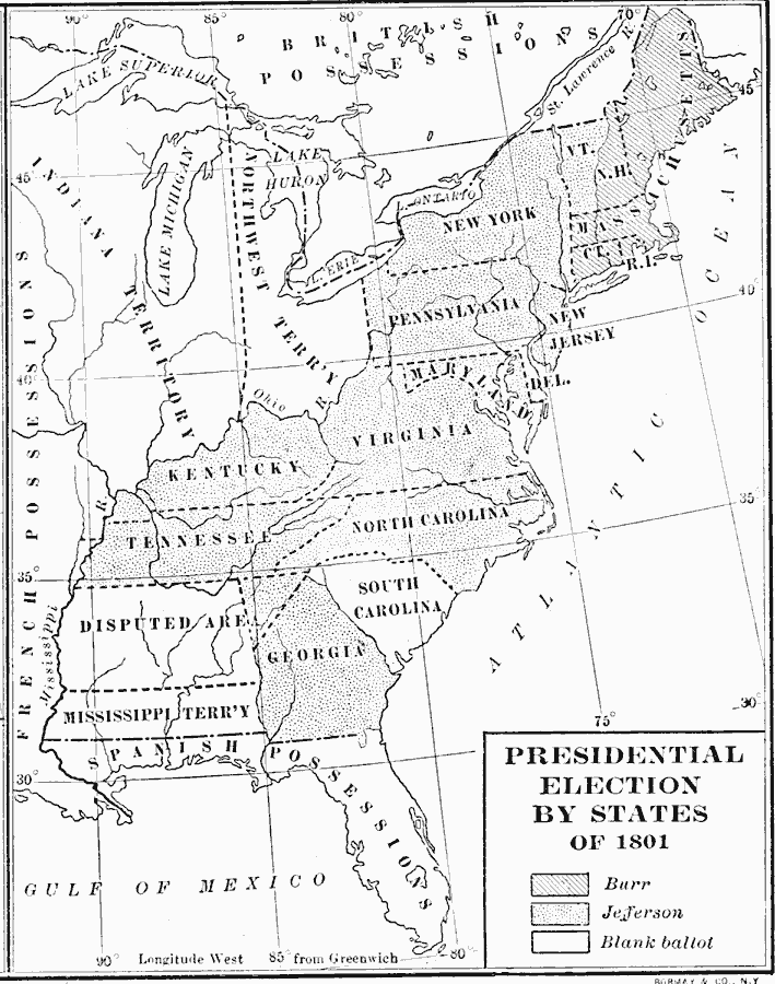
Description: A map of the United States showing the results of the 1801 presidential election, and shows the 16 states, territories, disputed areas, and Spanish Florida. At the time, the Vice Presidency was determined by the Electoral College, with the candidate receiving the second largest number of votes being assigned the office. The running mates in the campaign were Thomas Jefferson and Aaron Burr. Due to political actions by the Federalist Party, whose candidate, John Adams, had lost the general election and were opposed to Jefferson, the votes were deadlocked. The deadlock was broken by Alexander Hamilton, whose actions were one cause of his duel with Burr, which resulted in Hamilton's death in 1804.
Place Names: Elections, Presidential Electio
ISO Topic Categories: inlandWaters,
location,
oceans,
boundaries
Keywords: Presidential Election by States, physical, �political, physical features, country borders,
major political subdivisions, inlandWaters,
location,
oceans,
boundaries, Unknown, 1801
Source: Albert Bushnell Hart, LL.D., The American Nation Vol 11 (New York, NY: Harper and Brothers, 1906) 290
Map Credit: Courtesy the private collection of Roy Winkelman |
|