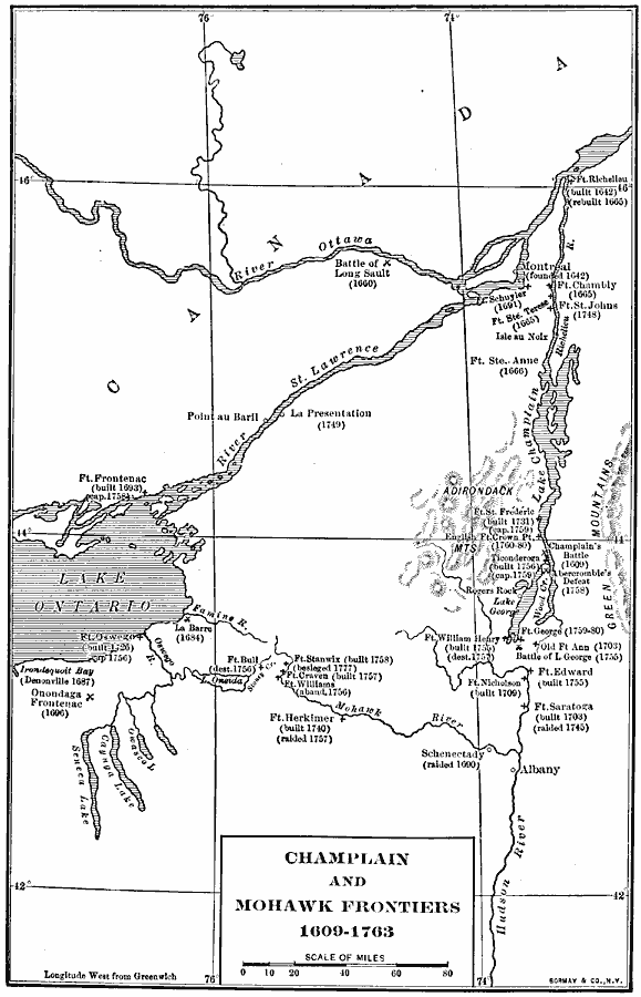
Description: A map of the Lake Champlain region and Mohawk frontiers during the period between the battle of Samuel Champlain against the Iroquois in 1609 near Crown Point and Ticonderoga, and the end of the French and Indian War in 1763. The map shows the region from western Lake Ontario to the Green Mountains, and from north of the River Ottawa to south of Albany, including lakes Champlain, Oneida, Owasco, Caynga, Seneca, and the rivers Oswego, Famine, Mohawk, St. Lawrence, and northern Hudson. The map shows forts with dates built, and in cases raided, captured, abandoned, or destroyed, and the sites with dates of significant battles.
Place Names: A Regional Map of North America, United States, �Canad
ISO Topic Categories: boundaries,
inlandWaters,
location
Keywords: Champlain and Mohawk Frontiers, physical, �political, physical features, local jurisdictions, boundaries,
inlandWaters,
location, Unknown, 1609–1763
Source: Albert Bushnell Hart, LL.D., The American Nation Vol 7 (New York, NY: Harper and Brothers, 1906) 204
Map Credit: Courtesy the private collection of Roy Winkelman |
|