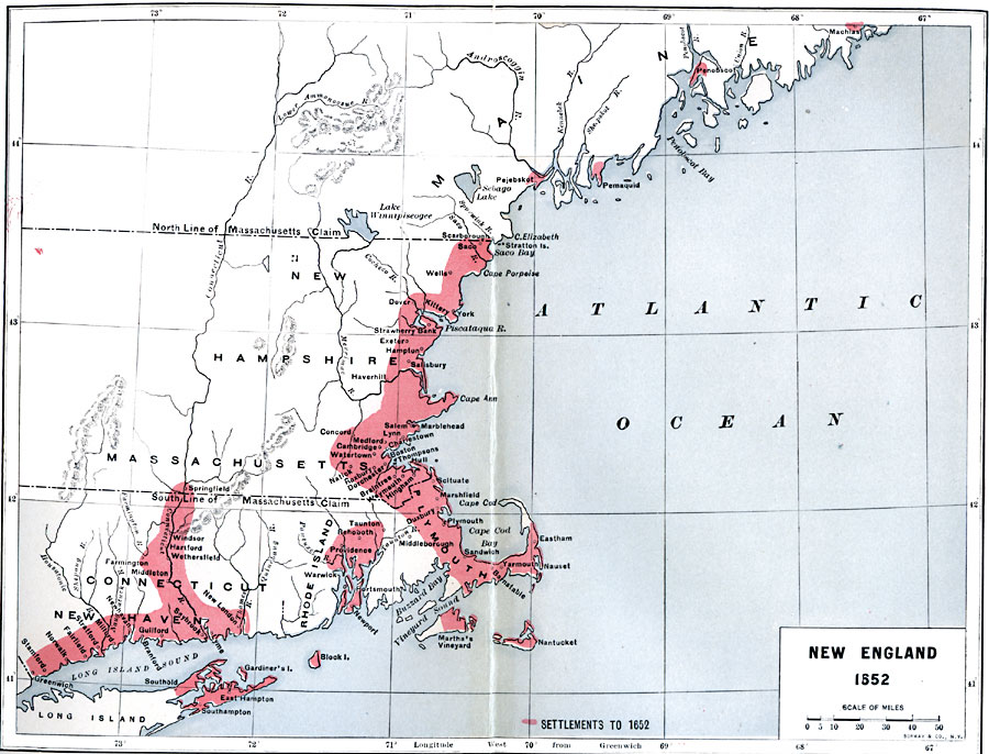
Description: New England in 1652.
Place Names: New England States, Plymouth, �Hampton,�New York, �Guilford, �New Englan
ISO Topic Categories: boundaries,
location,
inlandWaters,
oceans
Keywords: New England, physical, �political, physical features, local jurisdictions,
major political subdivisions, boundaries,
location,
inlandWaters,
oceans, Unknown, 1652
Source: Albert Bushnell Hart, LL.D., The American Nation Vol 4 (New York, NY: Harper and Brothers, 1906) 196
Map Credit: Courtesy the private collection of Roy Winkelman |
|