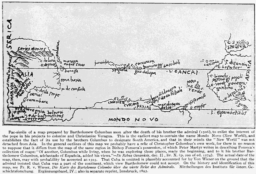
Description: A facsimile of a map prepared by Bartholomew Columbus soon after the death of his brother the admiral (1506), to enlist the interest of the pope in his projects to colonize and Christianize Veragua.
Place Names: Regional Atlantic Ocean, Africa, �South America, �Asia, �Europ
ISO Topic Categories: physical, kEarlyMapsFacsimile, kWorldAtlantic
Keywords: The New World according to Columbus, physical, kEarlyMapsFacsimile, physical features, physical, kEarlyMapsFacsimile, kWorldAtlantic, Unknown, 1506
Source: Albert Bushnell Hart, LL.D., The American Nation Vol 3 (New York, NY: Harper and Brothers, 1906) 96
Map Credit: Courtesy the private collection of Roy Winkelman |
|