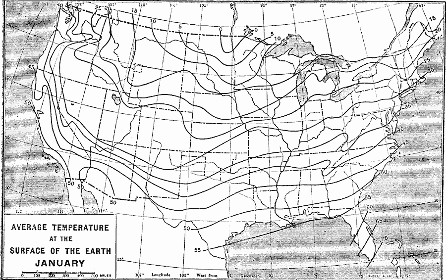
Description: A map from 1906 of the United States showing isotherms of mean surface temperatures in the region for the month of January.
Place Names: Meteorology, temperatur
ISO Topic Categories: boundaries,
location,
oceans,
inlandWaters,
climatologyMeteorologyAtmosphere
Keywords: Average Temperature in January, physical, �political, �meteorological, kClimate, physical features, major political subdivisions,
country borders, temperature, boundaries,
location,
oceans,
inlandWaters,
climatologyMeteorologyAtmosphere, Unknown, 1906
Source: Albert Bushnell Hart, LL.D., The American Nation Vol 2 (New York, NY: Harper and Brothers, 1906) 19
Map Credit: Courtesy the private collection of Roy Winkelman |
|