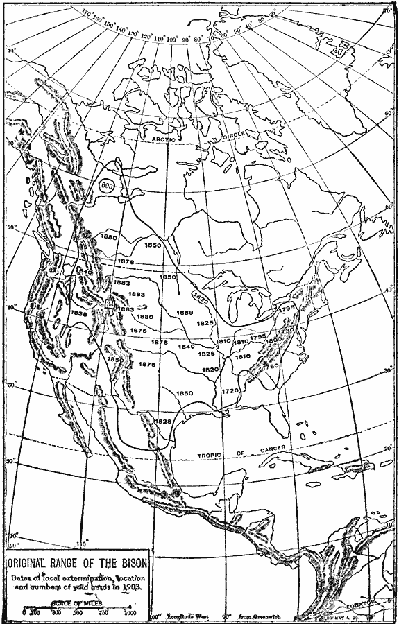
Description: A map of North America showing the original range of the American bison. The map shows the dates of local extermination, location, and numbers of wild animals in 1903 (Central Canada and the Rockies). "Beyond all doubt the most noteworthy of all North American animals is the bison, or "buffalo," by reason of its majestic size, former countless numbers, its practical value, and its lamentable extermination. Originally the bison ranged from the Alleghenies to the Rockies and even farther west into Oregon and Nevada, and from Great Slave Lake southward nearly to central Mexico. By 1800 the species was practically exterminated east of the Mississippi, and by the middle of the century the buffalo were restricted to the great plains, where they continued to roam by the millions, until 1869, when the completion of the Union Pacific Railway divided them into a "northern herd" and a "southern herd," and initiated the end of the race." — Farrand, 1906, p. 62.
Place Names: A Complete Map of North America, Bahamas, �Canada, �Cuba, �Mexico, �United State
ISO Topic Categories: biota,
boundaries,
inlandWaters,
location,
oceans
Keywords: Original Range of the Bison, physical, �political, �animal, kBiodiversity, physical features, country borders, biota,
boundaries,
inlandWaters,
location,
oceans, Unknown, 1720–1903
Source: Albert Bushnell Hart, LL.D., The American Nation Vol 2 (New York, NY: Harper and Brothers, 1906) 62
Map Credit: Courtesy the private collection of Roy Winkelman |
|
