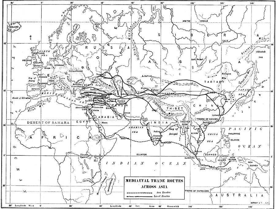
Description: A map from 1906 showing the medieval trade routes from Europe across Asia. The map shows the important trade centers of the Black Sea and Caspian Sea (Constantinople, Trebizon, Tana, Kaffa, Astrakhan, and Asterabad), the coast of Asia Minor and Syria (Smyrna, Adayah, Antioch, Laodicea, and Jaffa), the Nile Delta (Alexandria and Cairo), overland centers (Damascus, Bagdad, Tabriz, Ormuz, Kashgar, Karkand, and Balkh), the Indian centers (Delhi, Calicut, Pulicat), and Oriental centers (Malacca, Zayton, Quinsay, Pekin, the Spice Islands and Japan).
Place Names: Regional Miscellaneous, Africa, �Asia, �Australia, �Europ
ISO Topic Categories: kWorldEurasia, kWorldAfroAsia, kWorldEuroAfrica
Keywords: Medieval Trade Routes Across Asia, kWorldEurasia, kWorldAfroAsia, kWorldEuroAfrica, Unknown, 1200–1500
Source: Albert Bushnell Hart, LL.D., The American Nation Vol 1 (New York, NY: Harper and Brothers, 1906) 24
Map Credit: Courtesy the private collection of Roy Winkelman |
|