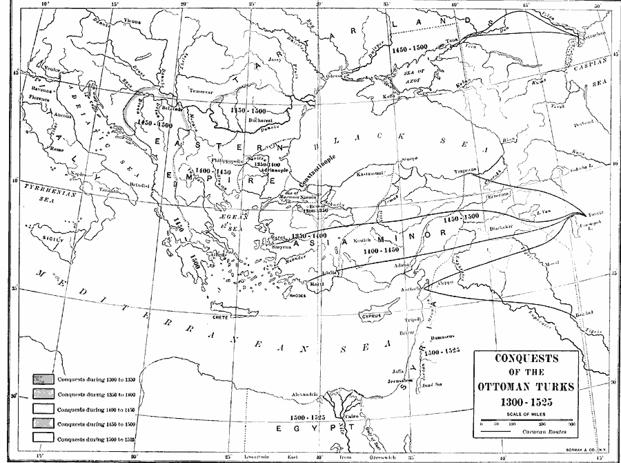
Description: A map showing the conquests of the Ottoman Turks from the end of the Seljuk Sultanate period in 1300, to the conquering of the Kingdom of Hungary in the north and the conquest of Egypt in the south in 1525. The map shows the location of the city Nicaea, near the battlefield of Bapheus where the Turk Osman I defeated the Byzantines in 1302, and the Ottomans began their spread north and south. Dashed lines show the territorial extent of the subsequent periods of conquest. The map also shows the important caravan routes of the time including the Black Sea port of Trebizond, the Mediterranean and Aegean ports of Antioch and Smyrna, and the inland trade centers of Bagdad and Tabriz.
Place Names: Regional EurAsia, Africa, �Europe, �Asi
ISO Topic Categories: physical, �political, �historical, kWorldMedSea, kWorldEurasia, kWorldAfroAsia
Keywords: Conquest of the Ottoman Turks, physical, �political, �historical, physical features, major political subdivisions, other military, physical, �political, �historical, kWorldMedSea, kWorldEurasia, kWorldAfroAsia, Unknown, 1300–1525
Source: Albert Bushnell Hart, LL.D., The American Nation Vol 1 (New York, NY: Harper and Brothers, 1906) 34
Map Credit: Courtesy the private collection of Roy Winkelman |
|