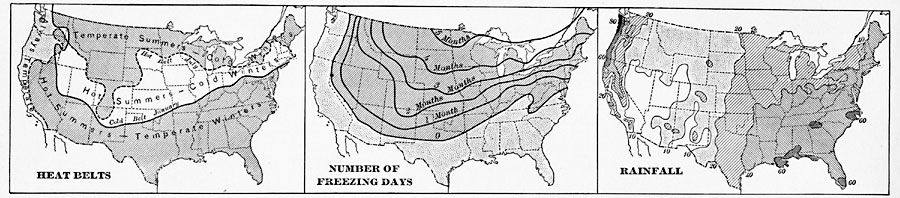
Description: A series of three climate maps from 1901 showing the general heat belts, mean number of freezing days, and rainfall distribution in the United States. The left–hand map shows the southern limit of the January cold belt (isotherm of 30° F.) and northern limit of the July heat belt (isotherm of 70° F.), the middle map shows the average number of days annually with freezing temperatures, and the right–hand map shows mean annual rainfall patterns within enclosed lines ranging from 10 inches to 80 inches.
Place Names: Meteorology, rainfall, �temperature, �fros
ISO Topic Categories: boundaries,
inlandWaters,
oceans
Keywords: United States Climate, physical, �meteorological, kClimate, physical features, climate,
rainfall,
temperature, boundaries,
inlandWaters,
oceans, Unknown, 1901
Source: Jacques W. Redway, Natural Advanced Geography (New York, NY: American Book Company, 1901) 54
Map Credit: Courtesy the private collection of Roy Winkelman |
|