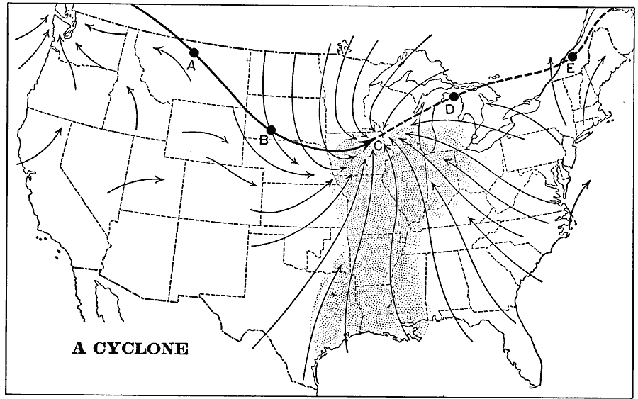
Description: A map from 1901 of the United States showing typical cyclonic storm activity. The map shows the storm track (solid line) and position of the storm center at 24 hour intervals (A, B, and C), and the projected track (dashed line) locations (D and E), and the warm, moist winds from the Gulf, and cool, dry winds from the north. The map illustrates how the warm, moist air is pushed eastward by the storm, while the cool, dry air is pulled behind, producing the moist conditions in the east and arid conditions in the west.
Place Names: Meteorology, Wind
ISO Topic Categories: boundaries,
inlandWaters,
oceans
Keywords: Typical Cyclone Events, physical, �meteorological, kClimate, physical features, winds, boundaries,
inlandWaters,
oceans, Unknown, 1901
Source: Jacques W. Redway, Natural Advanced Geography (New York, NY: American Book Company, 1901) 54
Map Credit: Courtesy the private collection of Roy Winkelman |
|