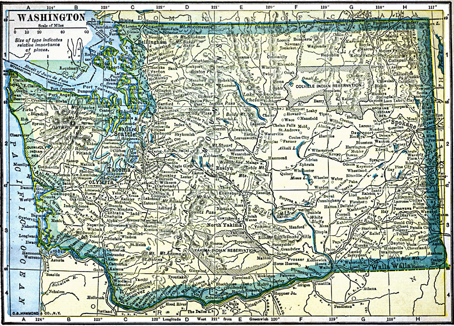
Description: A map from 1909 of Washington showing the capital, Olympia, counties and county seats, principal cities and towns, railroads, mountains, lakes, rivers, and coastal features of the Puget Sound and Pacific.
Place Names: Washington, Olympia, �Seattle, �Spokane, �Tacoma, �Vancouver, �Walla Walla, �Yakim
ISO Topic Categories: oceans,
location,
inlandWaters
Keywords: Washington, historical, �Indian reservations, �local jurisdictions, �political, historical, kNativeAmerican, local jurisdictions, oceans,
location,
inlandWaters, Unknown, 1909
Source: C. S. Hammond, Hammond's Handy Atlas of the World (New York, NY: C. S. Hammond & Company, 1911) 65
Map Credit: Courtesy the private collection of Roy Winkelman |
|