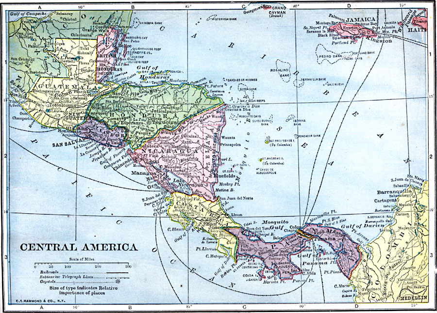
Description: A map from 1909 of Central America showing political boundaries at the time, capitals and major cities, railroads, submarine telegraph cables, mountain systems, lakes, rivers, coastal features, banks or reefs, and the islands of Jamaica and Grand Cayman. The map includes the countries of British Honduras (Belize), Guatemala, Salvador, Honduras, Nicaragua, Zelaya (the Mosquito Reservation), Costa Rica, and Panama with the Canal Zone.
Place Names: A Regional Map of North America, Columbia, �Costa Rica, �Guatemala, �Honduras, �Jamaica, �Nicaragua, �Panama, �Salvador, �Central America,
ISO Topic Categories: oceans,
location,
inlandWaters
Keywords: Central America, local jurisdictions, �political, �railroads, �transportation, kCentralAmerica, local jurisdictions, railroads, oceans,
location,
inlandWaters, Unknown, 1909
Source: C. S. Hammond, Hammond's Handy Atlas of the World (New York, NY: C. S. Hammond & Company, 1911) 73
Map Credit: Courtesy the private collection of Roy Winkelman |
|