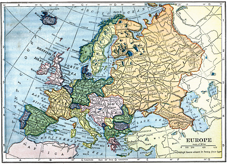
Description: A map of the political boundaries in Europe as they existed in 1909, including the German Empire and Austria–Hungary. This map also shows major cities and railroad routes.
Place Names: A Complete Map of Europe, France, �Germany, �Greece, �Italy, �Poland, �Portugal, �Romania, �Spain, �Sweden, �United Kingdo
ISO Topic Categories: oceans,
location,
inlandWaters
Keywords: Europe, local jurisdictions, �political, �local jurisdictions, oceans,
location,
inlandWaters, Unknown, 1909
Source: C. S. Hammond, Hammond's Handy Atlas of the World (New York, New York: C. S. Hammond & Company, 1911) 76
Map Credit: Courtesy the private collection of Roy Winkelman |
|