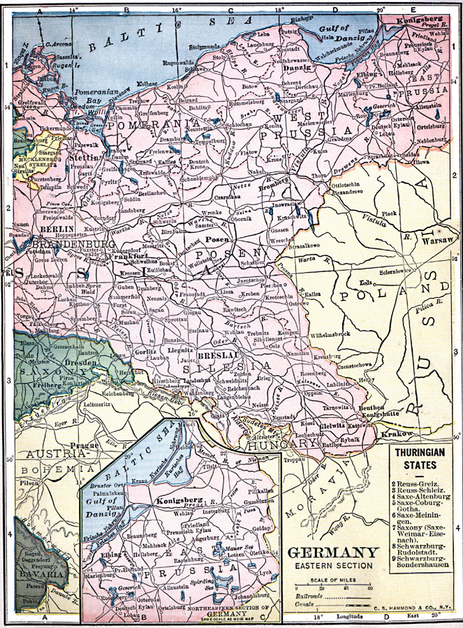
Description: A map of the eastern section of Germany in 1909. The map shows Prussia east of Berlin up to Konigsberg on the Baltic Sea and extending down into Silesia. Portions of the German territories of Saxony, Mecklenburg, and Bavaria are shown, as well as portions of Poland and Austria. Major cities, railroads, and rivers are shown, as well as a reference key to the Thuringian States and an inset map showing the area around Konigsberg.
Place Names: Germany, Berlin, �Dresden, �Frankfurt am Main, �Wiesbade
ISO Topic Categories: oceans,
location,
inlandWaters
Keywords: Germany - Eastern Section, local jurisdictions, �railroads, �political, �transportation, local jurisdictions, railroads, oceans,
location,
inlandWaters, Unknown, 1909
Source: C. S. Hammond, Hammond's Handy Atlas of the World (New York, New York: C. S. Hammond & Company, 1911) 79
Map Credit: Courtesy the private collection of Roy Winkelman |
|