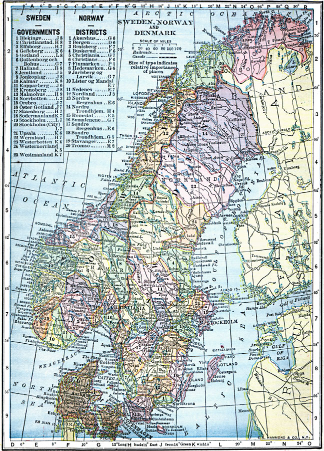
Description: A map from 1909 of Sweden, Norway, and Denmark showing major cities, ports, and towns, railroads, canals, rivers, coastal features, and mountain systems. This map is color–coded to show the governmental districts of Sweden and Norway, with a number reference key. This map shows the Danish border with Germany south of Jutland, with Schleswig to Germany. On this map, the Norwegian capital of Oslo is labeled with the former name "Christiania."
Place Names: Scandinavia, Christiania, �Copenhagen, �Denmark, �Norway, �Stockholm, �Swede
ISO Topic Categories: oceans,
location,
inlandWaters
Keywords: Sweden, Norway, and Denmark, local jurisdictions, �railroads, �political, �transportation, local jurisdictions, railroads, oceans,
location,
inlandWaters, Unknown, 1909
Source: C. S. Hammond, Hammond's Handy Atlas of the World (New York, NY: C. S. Hammond & Company, 1911) 80
Map Credit: Courtesy the private collection of Roy Winkelman |
|