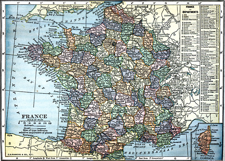
Description: A map of France in 1909, showing major cities and towns, rivers, canals, and railroads. This map is color–coded to show the administrative Departments of France with their capitals. The map has a reference key to the Departments and an inset map of the French controlled island of Corsica.
Place Names: France, Bordeaux, �Dunkerque, �Grenoble, �Lyon, �Nancy, �Nice, �Orleans, �Paris, �Starsbourg, �Tour
ISO Topic Categories: oceans,
location,
inlandWaters
Keywords: France, local jurisdictions, �railroads, �political, �transportation, local jurisdictions, railroads, oceans,
location,
inlandWaters, Unknown, 1909
Source: C. S. Hammond, Hammond's Handy Atlas of the World (New York, New York: C. S. Hammond & Company, 1911) 82
Map Credit: Courtesy the private collection of Roy Winkelman |
|