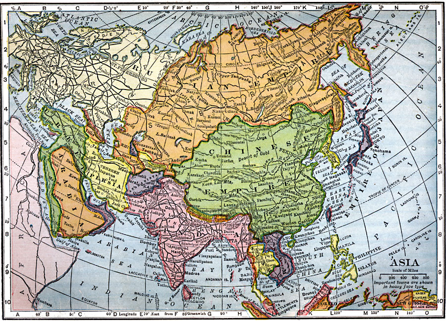
Description: A map of Asia from 1909 showing country boundaries at the time, foreign possessions, major cities, rivers, lakes, terrain, and coastal features. This map shows the principal railways of the region with connections to Europe. The map shows the extent of the Russian Empire and Turkish Ottoman Empire in Asia, and the territories of the Empire of Japan and the Chinese Empire.
Place Names: A Complete Map of Asia, China, �India, �Indonesia, �Japan, �Kazakhstan, �Mongolia, �Pakistan, �Phillipines, �Russia, �Thailand,�Chinese Empire
ISO Topic Categories: oceans,
location,
inlandWaters
Keywords: Asia, local jurisdictions, �political, �local jurisdictions, railroads, oceans,
location,
inlandWaters, Unknown, 1909
Source: C. S. Hammond, Hammond's Handy Atlas of the World (New York, NY: C. S. Hammond & Company, 1911) 86
Map Credit: Courtesy the private collection of Roy Winkelman |
|