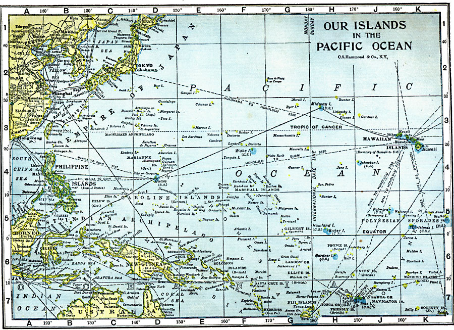
Description: A map of the Pacific from 1909 showing the territories and possessions of the United States at the time highlighted in blue. The map coverage is between latitudes 45° N and 20° S, and longitudes 110° E and 150° W of Greenwich. This map shows cities and ports, ocean steamer routes (dashed lines) with distances between major ports given in nautical miles, submarine cable routes (solid lines), rivers, coral reefs, and coastal features of the region. The map shows the International Date Line along the 180° meridian with no deviations with respect to national boundaries.
Place Names: Regional Pacific Ocean, Australia, �Borneo, �Caroline Islands, �China, �Fiji Islands, �Java, �Marshall Islands, �New Guinea, �Philippine Islands, �Samo
ISO Topic Categories: local jurisdictions, �political, kWorldPacific
Keywords: Our Islands in the Pacific Ocean, local jurisdictions, �political, �local jurisdictions, railroads, local jurisdictions, �political, kWorldPacific, Unknown, 1909
Source: C. S. Hammond, Hammond's Handy Atlas of the World (New York, NY: C. S. Hammond & Company, 1911) 87
Map Credit: Courtesy the private collection of Roy Winkelman |
|