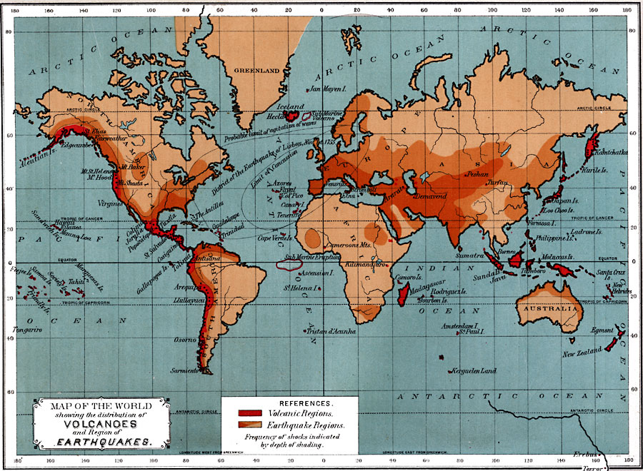
Description: A world map from 1891 showing the distribution of volcanoes and regions of earthquakes. This map is color–coded to show volcanic regions and earthquake regions, with the frequency of shocks in the earthquake regions indicated by the depth of shading. This map shows the locations of several prominent volcanoes around the world, including Erebus and Terror (named after the ships of Antarctic explorer John Ross), on the relatively unexplored Antarctic continent, and the submarine volcanoes off the coast of Iceland and between Africa and South America. This map also shows the district affected by the earthquake of Lisbon (estimated magnitude 9 on the Richter scale), which occurred on November 1, 1755, showing the limit of concussion, and the probable limit of the agitation of waves (Tsunami) which followed.
Place Names: A Complete Map of Globes and Multi-continent, Earth, �earthquakes, �volcanoe
ISO Topic Categories: climatologyMeteorologyAtmosphere
Keywords: Map of the World Showing the Distribution of Volcanoes and Region of Earthquakes, Earth, �earthquakes, �meteorological, �volcanoes, climatologyMeteorologyAtmosphere, Unknown, 1891
Source: Edwin J. Houston, A. M. , The Elements of Physical Geography (Philadelphia, PA: Eldredge & Brother, 1891) 26
Map Credit: Courtesy the private collection of Roy Winkelman |
|
