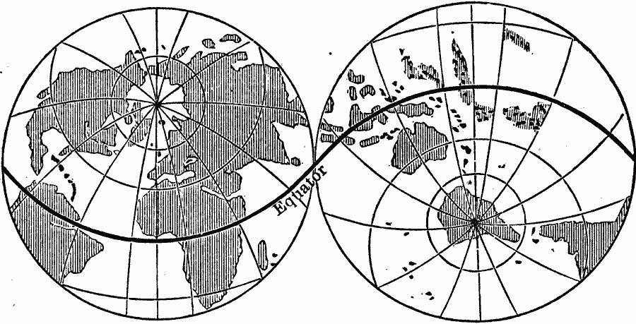
Description: A double hemisphere map of the world from 1891 showing the earth's Land Hemisphere and Water Hemisphere. "The accumulation of the land in the north and its separation in the south lead to a curious result — nearly all the land is collected in one hemisphere. If one point of a pair of compasses be placed at the north pole of a globe, and the other stretched out to reach to any point on the equator, they will describe on the surface of the globe a great circle, and consequently will divide the globe into hemispheres. If, while they are stretched this distance apart, one of these points be placed at about the city of London, a circle swept with the other point will divide the earth into land and water hemispheres. Such a great circle would pass through the Malay Peninsula and the coast of Peru. The Land Hemisphere contains all of North America, Europe, Africa, and the greater part of South America and Asia. The Water Hemisphere contains the southern portions of South America, the Malay Peninsula, and Australia." — Houston, 1891, p. 38.
Place Names: A Complete Map of Globes and Multi-continent, Earth, �hemispheres, �land, �wate
ISO Topic Categories: oceans,
location
Keywords: Land and Water Hemispheres, Earth, �hemispheres, �land, �physical, �water, physical features, oceans,
location, Unknown, 1891
Source: Edwin J. Houston, A. M. , The Elements of Physical Geography (Philadelphia, PA: Eldredge & Brother, 1891) 38
Map Credit: Courtesy the private collection of Roy Winkelman |
|
