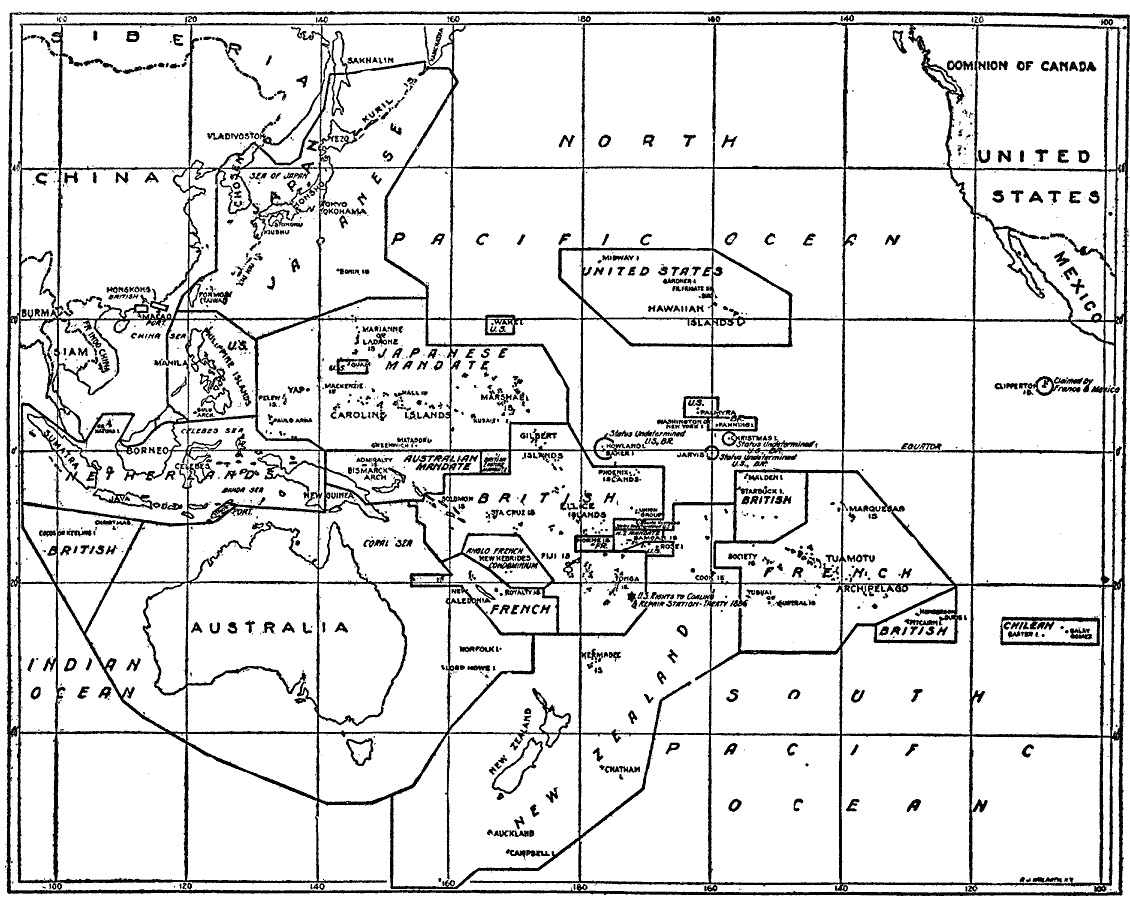
Description: A map from 1919 showing the islands and administrative boundaries of the Pacific, with new administration as fixed by the Supreme Council of the Allies. The question of American rights in some of these islands was among the topics discussed in arranging the four–power treaty at the Conference in Washington, 1921–1922. This map shows territories under Japanese mandate, those claimed by Britain, France, and the Netherlands, and the administrative territories of Australia, New Zealand, and the United States.
Place Names: Regional Pacific Ocean, Asia, �Australia, �North Americ
ISO Topic Categories: physical, �political, kWorldPacific
Keywords: Administration of the Pacific, physical, �political, physical features, country borders, physical, �political, kWorldPacific, Unknown, 1919
Source: Charles Morris, Winston's Cumulative Encyclopedia Vol 10 (Philadelphia, PA: The John C. Winston Company, 1919) tab 25
Map Credit: Courtesy the private collection of Roy Winkelman |
|