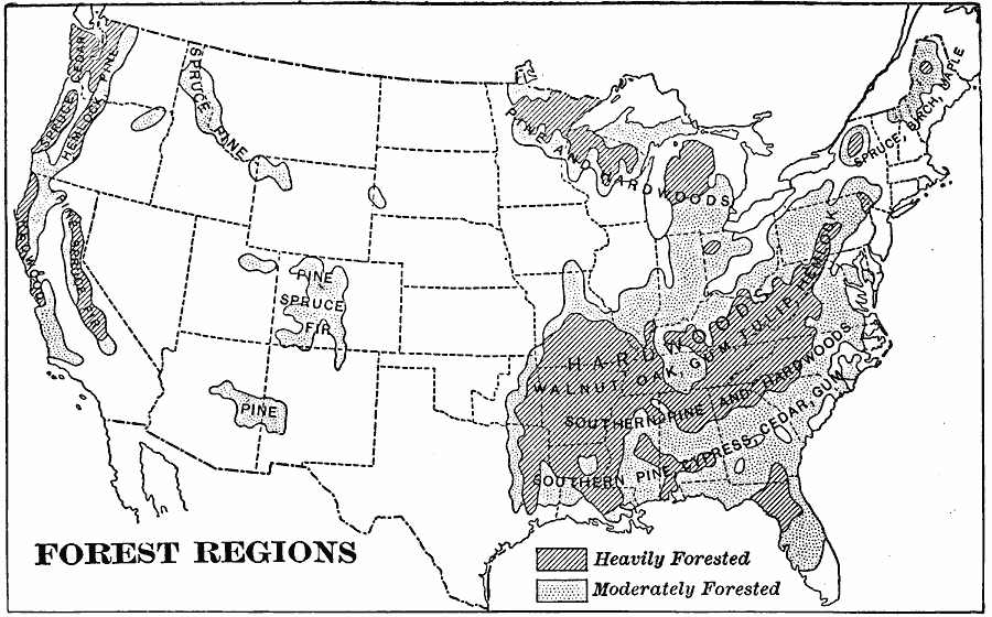
Description: A map from 1901 of the United States showing the forest regions, coded to show heavily forested and moderately forested areas. Areas of typical forest types are shown, including pine and hardwoods, spruce, birch, and maple in the northeast, hardwoods, southern pine, walnut, oak, gum, tulip, hemlock, cypress, and cedar in the southeast, pine, fir, and spruce in the Rocky Mountain region, and spruce, cedar, hemlock, pine, fir, and redwood along the Pacific northwest.
Place Names: Forestry,
ISO Topic Categories: boundaries,
biota,
inlandWaters,
oceans
Keywords: United States Forest Regions, physical, �political, �statistical, physical features, major political subdivisions,
country borders, vegetation, boundaries,
biota,
inlandWaters,
oceans, Unknown, 1901
Source: Jacques W. Redway, Natural Advanced Geography (New York, NY: American Book Company, 1901) 59
Map Credit: Courtesy the private collection of Roy Winkelman |
|