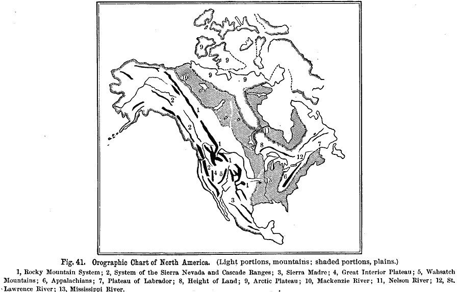
Description: An orographic map from 1891 of North America showing the principal mountain systems, rivers, and terrain features of the region. The map is coded to show high lands and mountain regions, and shaded regions of plains, with dark lines indicating the general direction of mountain ranges. The map is numbered to show the Rocky Mountain system (1), the system of the Sierra Nevada and Cascades ranges (2), the Sierra Madre in Mexico (3), the Great Interior Plateau (4), the Wahsatch Mountains (5), Appalachians (6), Plateau of Labrador (7), the Height of Land separating the central plains (8), the Arctic Plateau (9), and the river systems of the Mackenzie (10), Nelson to Hudson Bay (11), the St. Lawrence (12), and the Mississippi River system (13).
Place Names: A Complete Map of North America, United States, �Canad
ISO Topic Categories: oceans,
location,
inlandWaters
Keywords: Orographic Chart of North America, land, �mountains, �water, �physical, kOrographic, physical features,
topographical, oceans,
location,
inlandWaters, Unknown, 1891
Source: Edwin J. Houston, A. M. , The Elements of Physical Geography (Philadelphia, PA: Eldredge & Brother, 1891) 45
Map Credit: Courtesy the private collection of Roy Winkelman |
|