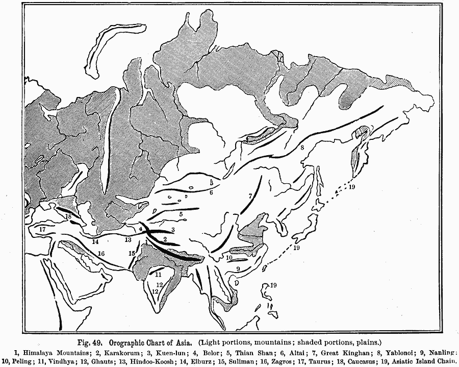
Description: A base map from 1891 showing the mountain systems of Asia. The map shows highlands in white, lowlands as shaded, and shows major mountain ranges with heavy black lines. Major rivers are shown. The map is keyed to show the Himalaya Mountains (1), Karakorum (2), Kuen-lun (3), Belor (4), Thian Shan (5), Altai (6), Great Kinghan (7), Yablonoi (8), Nanling (9), Peling (10), Vindhya (11), Ghauts (12), Hindoo-Koosh (13), Elburz (14), Suliman (15), Zagros (16), Taurus (17), Caucasus (18), and the Asiatic Island Chain (19).
Place Names: A Complete Map of Asia, China, �India, �Indonesia, �Japan, �Kazakhstan, �Mongolia, �Pakistan, �Phillipines, �Russia, �Thailan
ISO Topic Categories: oceans,
location,
inlandWaters
Keywords: Orographic Chart of Asia, land, �mountains, �water, �physical, physical features,
topographical, oceans,
location,
inlandWaters, Unknown, 1891
Source: Edwin J. Houston, A. M. , The Elements of Physical Geography (Philadelphia, PA: Eldredge & Brother, 1891) 50
Map Credit: Courtesy the private collection of Roy Winkelman |
|