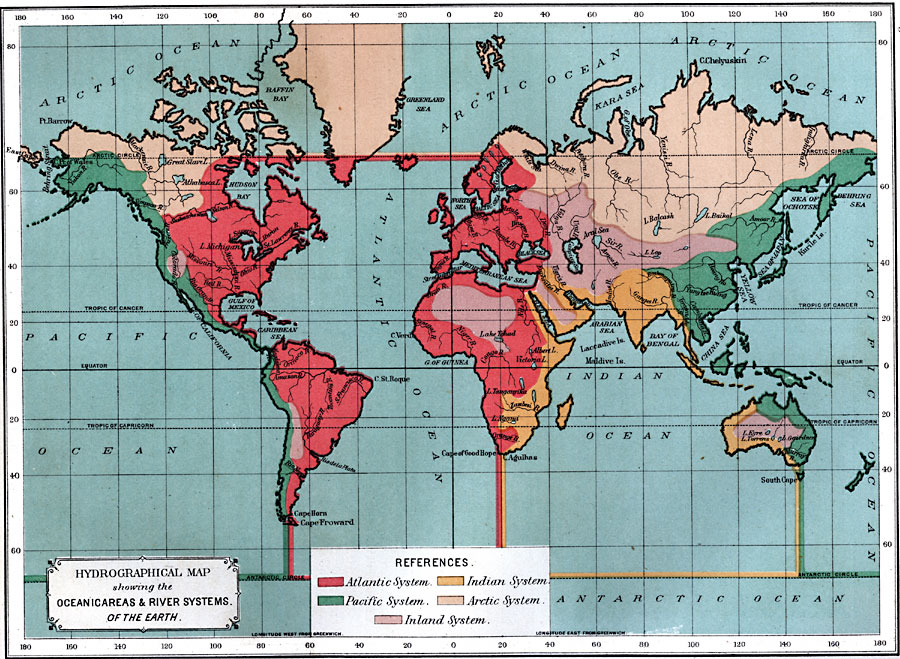
Description: A Hydrographical map from 1891 showing the oceans and river drainage systems of the globe. The map is color–coded to show the drainage systems of the Atlantic, Pacific, Arctic, and Indian oceans, and inland basins that do not drain to the ocean. The map shows major lake and river systems, and large bodies of water (oceans, seas, and bays).
Place Names: A Complete Map of Globes and Multi-continent, Africa, �Antarctica, �Asia, �Australia, �Europe, �North America, �South Americ
ISO Topic Categories: oceans,
location,
inlandWaters
Keywords: Hydrographical Map showing the Oceanic Areas and River Systems of the Earth, alluvial, �land, �water, �physical, �hydrological, kHydrologic, physical features,
topographical, oceans,
location,
inlandWaters, Unknown, 1891
Source: Edwin J. Houston, A. M. , The Elements of Physical Geography (Philadelphia, PA: Eldredge & Brother, 1891) 68
Map Credit: Courtesy the private collection of Roy Winkelman |
|