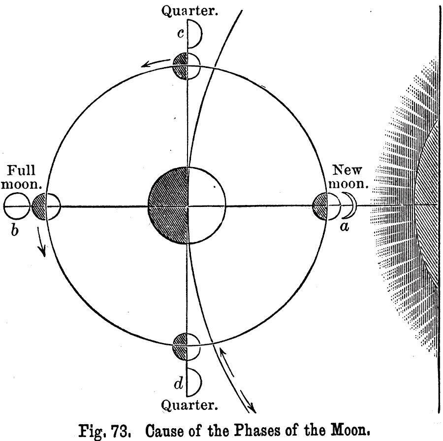
Description: A map of the Earth, Moon, and Sun from 1891, showing the cause of the phases of the Moon due to its relative positions with the Earth. "An inspection of Fig. 73 will show, that during new and full moon, the earth, moon, and sun are all in the same straight line, but, that during the first and last quarters, they are at right angles. The portions of the earth and moon turned toward the sun are illuminated, the shaded portions are in the darkness. To an observer on the earth, the moon, at (a), appears new, since the dark part is turned toward him; at (b), however, it must appear full, since the illuminated portions are toward him. At (c), and (d), the positions of the quarters, only one–half of the illuminated half, or one quarter, is seen."
Place Names: A Regional Map of Astronomical,
ISO Topic Categories: climatologyMeteorologyAtmosphere
Keywords: Cause of the Phases of the Moon, lunar tide, �water, climatologyMeteorologyAtmosphere, Unknown, 1891
Source: Edwin J. Houston, A. M. , The Elements of Physical Geography (Philadelphia, PA: Eldredge & Brother, 1891) 77
Map Credit: Courtesy the private collection of Roy Winkelman |
|
