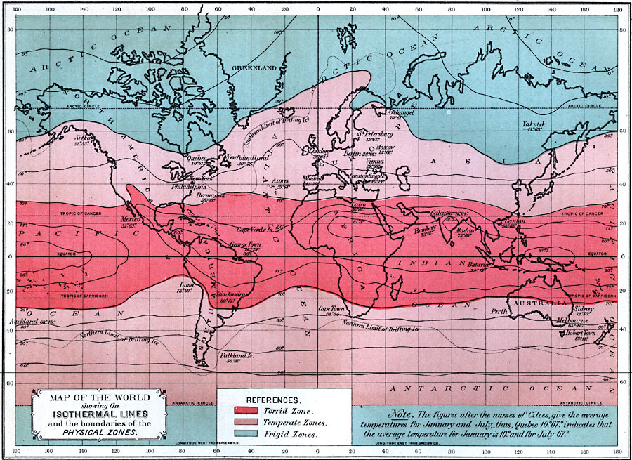
Description: A world map from 1891 showing the isothermal lines and the boundaries of the physical temperature zones. This map is color–coded to show the Torrid Zone, Temperate Zones, and Frigid Zones as defined by mean isotherms, with the torrid zone between temperatures above 70° F., temperate zones between 70° and 30° F., and the frigid zones below 30° Fahrenheit. Isotherms for mean annual temperatures from 0° to 80° Fahrenheit are shown, as well as the limits of polar drifting ice. The figures following the names of cities on this map indicate average temperatures for that city in January and July in degrees Fahrenheit.
Place Names: A Complete Map of Globes and Multi-continent, Africa, �Antarctica, �Asia, �Australia, �Europe, �North America, �South Americ
ISO Topic Categories: oceans,
location,
inlandWaters,
climatologyMeteorologyAtmosphere
Keywords: Map of the World showing the Isothermal Lines and the boundaries of the Physical Zones, climate, �land, �meteorological, �temperature, kClimate, temperature,
climate, oceans,
location,
inlandWaters,
climatologyMeteorologyAtmosphere, Unknown, 1891
Source: Edwin J. Houston, A. M. , The Elements of Physical Geography (Philadelphia, PA: Eldredge & Brother, 1891) 88
Map Credit: Courtesy the private collection of Roy Winkelman |
|