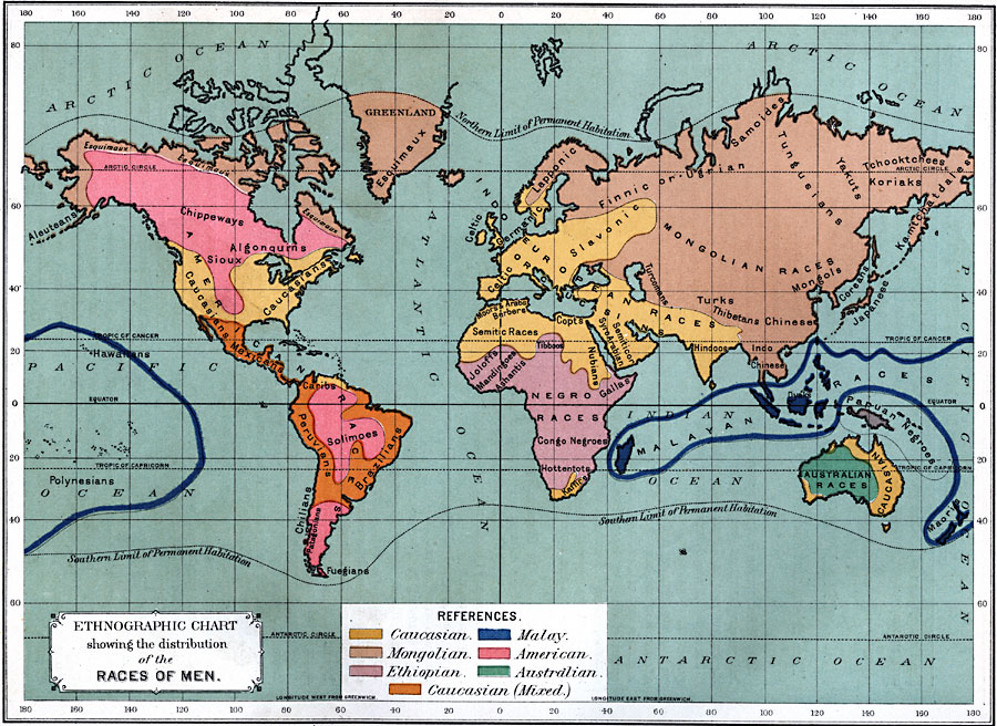
Description: A map from 1891 showing the ethnographic distribution of the "Races of Men." This map is color-coded to show the areas predominately occupied by, using the terminology of the time, Caucasians, Mongolians, Ethiopians, Malays, Americans, Australians, and Mixed Caucasians. The map shows the northern and southern limits of permanent habitation, and areas occupied by various groups as known at the time, including the Esquimaux, Chippeways, Algonqurns, Hawaiians, Polynesians, Mexicans, Caribs, Peruvians, Solimoes, Brazilians, Chilians, Patagonians, Fuegians, Lapponic, Celtic, Germanic, Finnic or Ugrian, Slavonic, Turcomans, Moors and Arabs, Berbers, Semitic Races, Joloffs, Mandingos, Ashantis, Copts, Nubians, Semiticor, Syro-Arabians, Tibboos, Gallas, Congo Negroes, Hottentots, Kaffirs, Samoides, Tungusians, Mongols, Turks, Thibetans, Chinese, Hindoos, Indo-Chinese, Dyaks, Yakuts, Tchooktchees, Koriaks, Kamtchatdales, Coreans, Japanese, Papuan Negroes, Maoris, and Australian Races.
Place Names: A Complete Map of Globes and Multi-continent, Africa, �Antarctica, �Asia, �Australia, �Europe, �North America, �South Americ
ISO Topic Categories: oceans,
location,
inlandWaters
Keywords: Ethnographic Chart showing the distribution of the Races of Men, ethnographic, �ethnological, �race, �statistical, kEthnic, ethnological, oceans,
location,
inlandWaters, Unknown, 1891
Source: Edwin J. Houston, A. M. , The Elements of Physical Geography (Philadelphia, PA: Eldredge & Brother, 1891) 136
Map Credit: Courtesy the private collection of Roy Winkelman |
|
