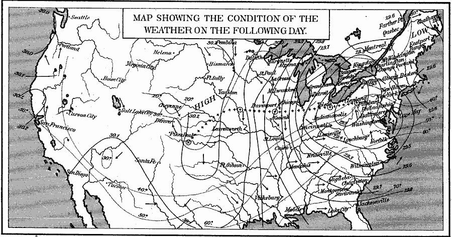
Description: A sample weather map from 1891 of the United States showing a typical storm event for a two day period in April. The map shows a low pressure system originating in the Western Plains near Pike's Peak moving to the northeast and east to Pittsburg, a high pressure system over the coastal Pacific moving inland over the Rocky Mountains and pushing the storm east, and includes isotherms of mean temperatures and lines of equal barometric pressure (isobars), both reduced to sea level, prevailing wind directions flying with the arrow symbols, the storm center, and the track of the storm center over the period of observation.
Place Names: Meteorology, Boston, �Chicago, �Houston, �Los Angeles, �Miami, �New Orleans, �New York, �San Diego, �Seattle, �Washington D.C
ISO Topic Categories: oceans,
location,
inlandWaters
Keywords: A Typical Two–Day April Storm Event, climate, �meteorological, �temperature, �winds, kClimate, winds,
climate,
temperature, oceans,
location,
inlandWaters, Unknown, 1891
Source: Edwin J. Houston, A. M. , The Elements of Physical Geography (Philadelphia, PA: Eldredge & Brother, 1891) 148
Map Credit: Courtesy the private collection of Roy Winkelman |
|