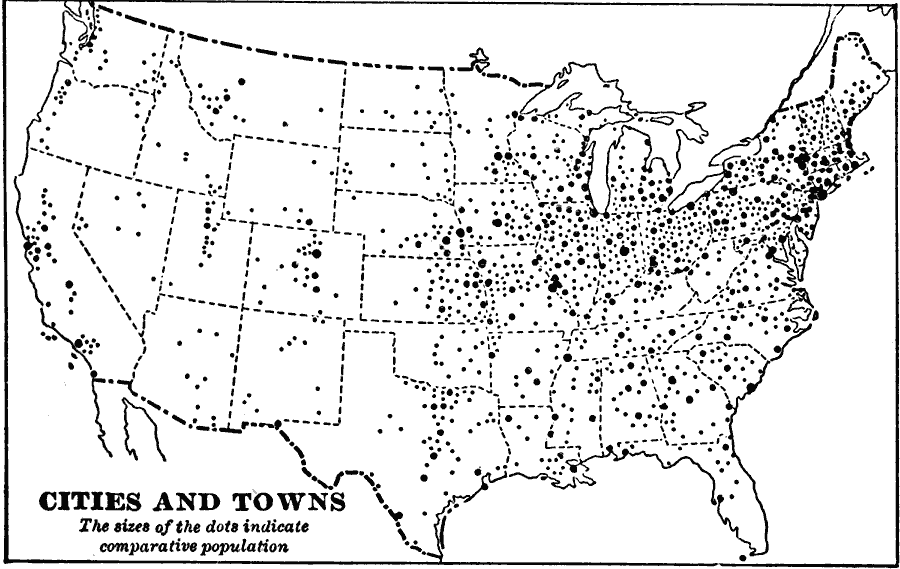
Description: A base map from 1897 of the contiguous 48 states showing the distribution pattern of the major cities and towns at the time. The size of the dots indicate comparative populations.
Place Names: Demographics, Boston, �Chicago, �Houston, �Los Angeles, �Miami, �New Orleans, �New York, �San Diego, �Seattle, �Washington D.C., �populatio
ISO Topic Categories: location,
oceans,
inlandWaters
Keywords: The United States - Cities and Towns, population, �statistical, kPopulation, population, location,
oceans,
inlandWaters, Unknown, 1897
Source: Jacques W. Redway & Russell Hinman, Natural Introductory Geography (New York, NY: American Book Company, 1897) 41
Map Credit: Courtesy the private collection of Roy Winkelman |
|