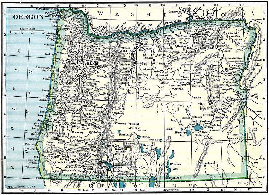
Description: A map from 1919 of Oregon showing the capital of Salem, principal cities and towns, Indian reservations, railroads, mountain systems, lakes, rivers, and coastal features.
Place Names: Oregon, Astoria, �Salem, �Portland, �Oregon City, �Eugene City, �Dalles, �Roseburg, �Umatilla, �Alban
ISO Topic Categories:
Keywords: Oregon, physical, �political, �transportation, kNativeAmerican, physical features, major political subdivisions, railroads, Unknown, 1919
Source: Charles Morris, Winston's Cumulative Encyclopedia Vol 7� (Philadelphia, PA: The John C. Winston Company, 1919) tab 20
Map Credit: Courtesy the private collection of Roy Winkelman |
|