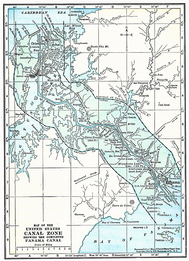
Description: A map from 1919 of the Panama Canal Zone showing the completed canal, the Panama Railway, the locks, breakwaters and dams, the Caribbean entry at Colon and Pacific entry at the City of Panama, the boundary with the Republic of Panama, the continental divide, hills, lakes with elevations, and feeding rivers of the area.
Place Names: Panama Canal Zone, Panama, �Caribbean Sea, �Cristobal, �Limon Bay, �United State
ISO Topic Categories: transportation,
boundaries,
location,
oceans,
inlandWaters
Keywords: The Panama Canal, physical, �political, �transportation, physical features, local jurisdictions, water routes, transportation,
boundaries,
location,
oceans,
inlandWaters, Unknown, 1919
Source: Charles Morris, Winston's Cumulative Encyclopedia Vol 7 (Philadelphia, PA: The John C. Winston Company, 1919) tab 22
Map Credit: Courtesy the private collection of Roy Winkelman |
|