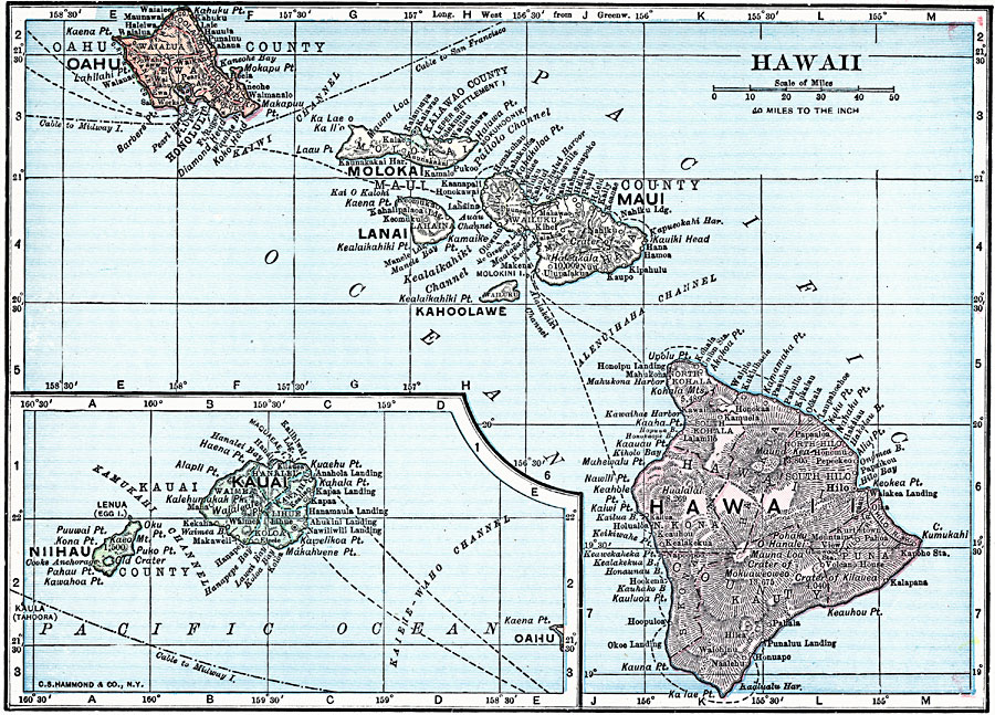
Description: A map from 1919 of the Hawaiian Islands showing the eight main islands of Hawaii, Maui, Kahoolawe, Lanai, Molokai, Oahu, Kauai, and Niihau, the capital of Honolulu on the island of Oahu, cities, towns, ports, railroads, submarine cable routes, terrain, and coastal features.
Place Names: Hawaii, Hilo, �Hana, �Honolulu, �Kaneohe, �Pahoa, �Pearl Cit
ISO Topic Categories: utilitiesCommunication,
boundaries,
inlandWaters,
location,
oceans
Keywords: Hawaii, physical, �political, physical features, local jurisdictions, utilitiesCommunication,
boundaries,
inlandWaters,
location,
oceans, Unknown, 1919
Source: Charles Morris, Winston's Cumulative Encyclopedia Vol 5 (Philadelphia, PA: The John C. Winston Company, 1919) tab 2
Map Credit: Courtesy the private collection of Roy Winkelman |
|