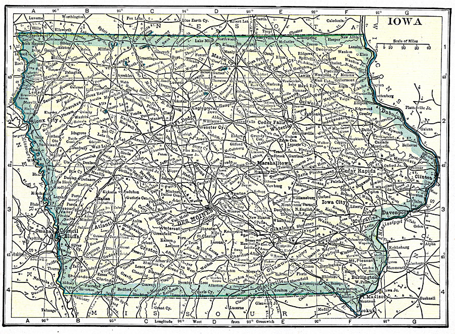
Description: A map from 1919 of Iowa showing the State capital of Des Moines, major cities and towns, railroads, and rivers, including the border rivers of the Mississippi and Missouri.
Place Names: Iowa, Cedar Falls, �Des Moines, �Clinton, �Creston, �Dubuque, �Hamburg, �Iowa City, �Mason, �Sioux City, �Waterlo
ISO Topic Categories: transportation,
location,
inlandWaters,
boundaries
Keywords: Iowa, physical, �transportation, �political, physical features, major political subdivisions, railroads, transportation,
location,
inlandWaters,
boundaries, Unknown, 1919
Source: Charles Morris, Winston's Cumulative Encyclopedia Vol 5 (Philadelphia, PA: The John C. Winston Company, 1919) tab 6
Map Credit: Courtesy the private collection of Roy Winkelman |
|