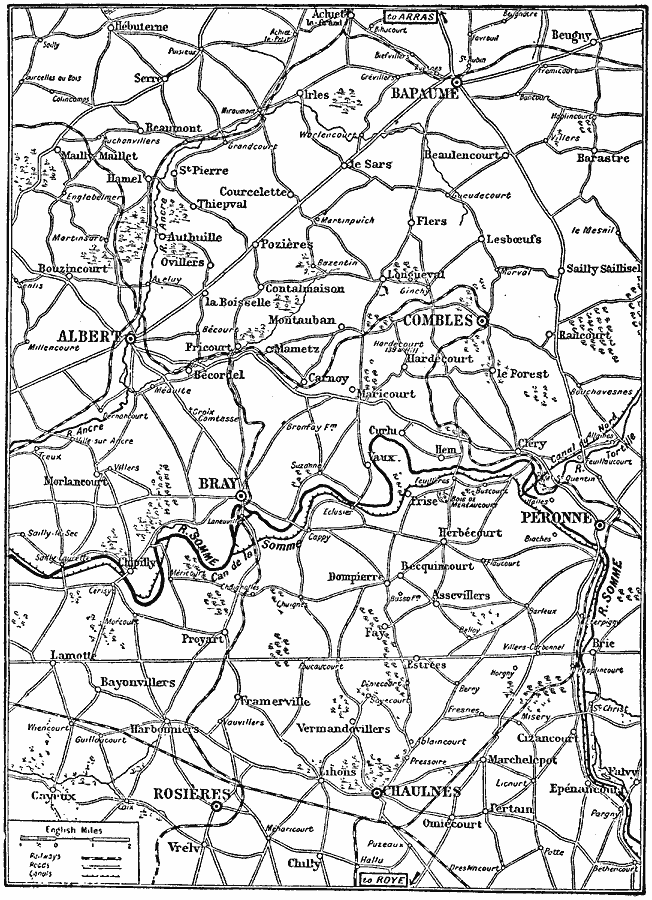
Description: A map of the area around the River Somme, France, where two significant battles of the Western Front during the First World War were fought. The map shows the primary cities of Bapaume, Albert, Combles, Peronne, Bray, Rosières, and Chaulnes, smaller towns and villages, railroad routes, roads, canals, and woodlands shown pictorially.
Place Names: France, Somme, �Bray, �Albert, �Peronn
ISO Topic Categories: boundaries,
intelligenceMilitary,
location,
inlandWaters,
transportation
Keywords: Battles of the Somme, political, �physical, �transportation, �historical, kWWI, physical features, local jurisdictions, railroads,
roads, WWI, boundaries,
intelligenceMilitary,
location,
inlandWaters,
transportation, Unknown, 1916–1918
Source: Charles Morris, Winston's Cumulative Encyclopedia Vol 4 (Philadelphia, PA: The John C. Winston Company, 1919) tab 1
Map Credit: Courtesy the private collection of Roy Winkelman |
|