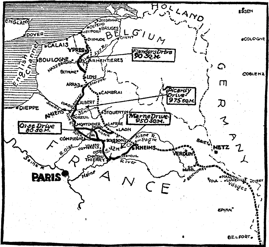
Description: A map of the final offensives of the German army from the Western Front into France in 1918. This map shows the First German Offensive (Picardy Drive, 21 March–4 April), which captured 975 square miles of territory and advanced the front 35 miles, the Second German Offensive (Flanders Drive, 9–29 April), which captured 90 square miles, the Third German Offensive (Marne Drive, 27 May–4 June), which captured 950 square miles and advanced the front 32 miles, and the Fourth German Offensive (Oise Drive, 8–12 June), which captured 80 square miles and advanced the front 6 miles.
Place Names: Western Europe, France, �Germany, �Belgiu
ISO Topic Categories: intelligenceMilitary,
boundaries,
inlandWaters,
location,
oceans
Keywords: Last Drives of the Germans in WWI, physical, �political, �historical, kWWI, physical features, country borders, WWI, intelligenceMilitary,
boundaries,
inlandWaters,
location,
oceans, Unknown, 1918
Source: Charles Morris, Winston's Cumulative Encyclopedia Vol 4 (Philadelphia, PA: The John C. Winston Company, 1919) tab 4
Map Credit: Courtesy the private collection of Roy Winkelman |
|