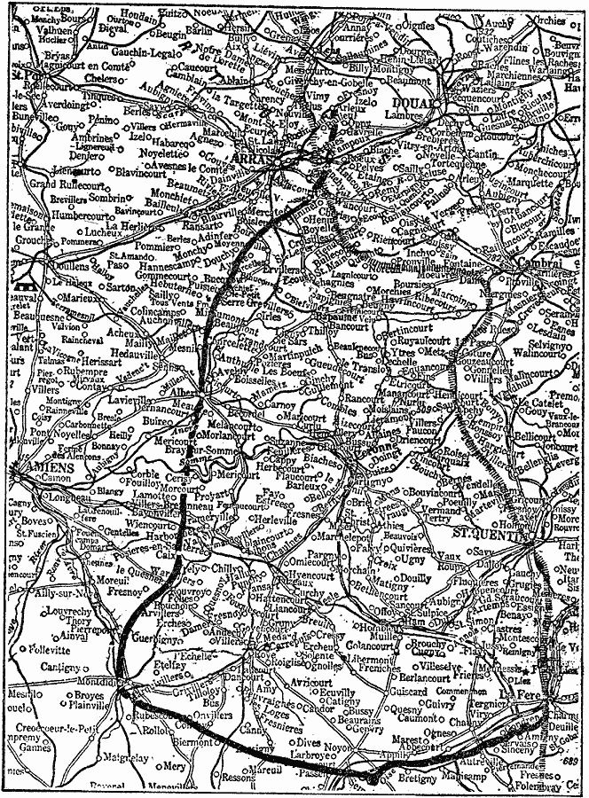
Description: A detail map of the Picardy region of France, showing the battle lines of the German offensive Picardy Drive prior to the Battle of the Somme (1916) in WWI. This map shows the Hindenburg Line (hachured), and the furthest western extent of the Picardy Drive.
Place Names: France, Amiens, St. Quentin, Arras
ISO Topic Categories: inlandWaters,
location,
transportation,
intelligenceMilitary
Keywords: Detail Map of the Picardy Drive, transportation, �physical, �political, �historical, kBattle, kWWI, physical features, local jurisdictions, roads, WWI, inlandWaters,
location,
transportation,
intelligenceMilitary, Unknown, 1916
Source: Charles Morris, Winston's Cumulative Encyclopedia Vol 4 (Philadelphia, PA: The John C. Winston Company, 1919) tab 5
Map Credit: Courtesy the private collection of Roy Winkelman |
|