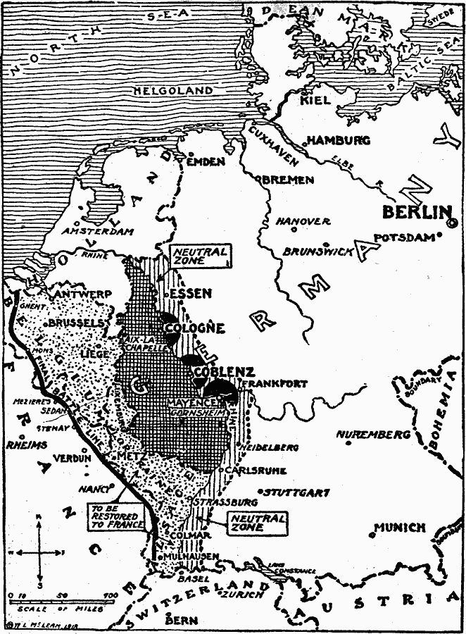
Description: A map of the Western Front showing the retirement of German forces after the armistice, the final battle line of the allied Hundred Days Offensive, the territories of Lorraine and Alsace to be restored to France, the neutral zone to the east of the Rhine River, and the Occupation Zones of the British around Cologne, Americans around Coblenz, and the French around Mayence (Meinz).
Place Names: Germany, Germany, �France, �Austria, �Switzerland, �Netherland
ISO Topic Categories: boundaries,
location,
oceans,
inlandWaters
Keywords: Armistice on the Western Front, historical, �physical, �political, kWWI, physical features, country borders, WWI, boundaries,
location,
oceans,
inlandWaters, Unknown, 1918
Source: Charles Morris, Winston's Cumulative Encyclopedia Vol 4 (Philadelphia, PA: The John C. Winston Company, 1919) tab 8
Map Credit: Courtesy the private collection of Roy Winkelman |
|