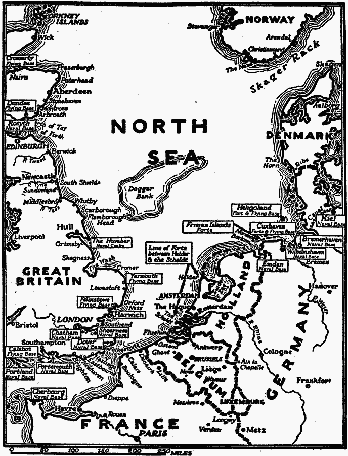
Description: A map showing forts and flying bases on the North Sea during WWI, including the naval bases of Rosyth in Scotland, The Humber, Sheerness, Chatham, Dover, Portsmouth and Portland in England, Cherbourg in France, and Emden, Wilhelmshaven, Bremerhaven, and Kiel in Germany. The flying bases include Cromarty and Dundee in Scotland, Yarmouth, Felixtowe, and Calshot in England, and Helgoland and Cuxhaven in Germany.
Place Names: Western and Central Europe, Norway, �Denmark, �Holland, �Belgium, �Germany, �France, �United Kingdo
ISO Topic Categories: boundaries,
intelligenceMilitary,
inlandWaters,
location,
oceans
Keywords: Forts and Flying Bases on the North Sea, physical, �political, �historical, kWWI, physical features, country borders, WWI, boundaries,
intelligenceMilitary,
inlandWaters,
location,
oceans, Unknown, 1914–1918
Source: Charles Morris, Winston's Cumulative Encyclopedia Vol 4 (Philadelphia, PA: The John C. Winston Company, 1919) tab 9
Map Credit: Courtesy the private collection of Roy Winkelman |
|