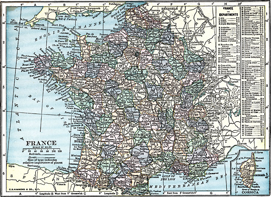
Description: A map of France in 1919, showing major cities and towns, rivers, canals, and railroads. This map is color–coded to show the administrative Departments of France with their capitals. The map has a reference key to the Departments and an inset map of the French controlled island of Corsica.
Place Names: France, Bordeaux, �Dunkerque, �Grenoble, �Lyon, �Marseille, �Nice, �Orleans, �Paris, �Tour
ISO Topic Categories: transportation,
inlandWaters,
location,
oceans,
boundaries
Keywords: France, physical, �political, �transportation, physical features, country borders,
major political subdivisions, railroads,
water routes, transportation,
inlandWaters,
location,
oceans,
boundaries, Unknown, 1919
Source: Charles Morris, Winston's Cumulative Encyclopedia Vol 4 (Philadelphia, PA: The John C. Winston Company, 1919) tab 14
Map Credit: Courtesy the private collection of Roy Winkelman |
|