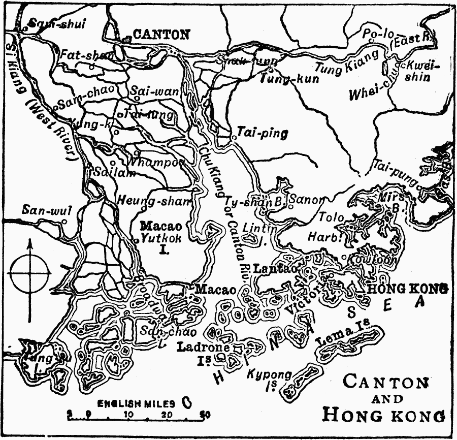
Description: A map from 1919 of the Pearl River delta from Canton (Guangzhou) to Hong Kong and Macao on the China Sea. At this time, Hong Kong was a possession of Great Britain, and Macao was officially a Portuguese colony. This map shows the river courses of the Chu Kiang (Pearl River or Zhujiang), Si Kiang (West River or Xijiang), and Tung Kiang (East River or Beijiang) through the delta, coastal features, and the cities of the area.
Place Names: China, Canton, �Hong Kong, �Macau, �Guangzho
ISO Topic Categories: boundaries,
inlandWaters,
location,
oceans
Keywords: Canton and Hong Kong, physical, �political, physical features, major political subdivisions, boundaries,
inlandWaters,
location,
oceans, Unknown, 1919
Source: Charles Morris, Winston's Cumulative Encyclopedia Vol 2 (Philadelphia, PA: The John C. Winston Company, 1919) tab 8
Map Credit: Courtesy the private collection of Roy Winkelman |
|