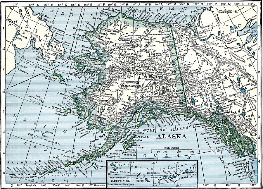
Description: A map of Alaska from 1919 showing the State capital at Juneau, cities, towns, ports, existing and proposed railroads, major rivers and mountains, coastal features, and islands. The map has an inset map of the western Aleutian Islands.
Place Names: Alaska, Valdez, �Kenai, �Skagway, �Sitka, �Kodiak, �Nom
ISO Topic Categories: boundaries,
location,
oceans,
inlandWaters
Keywords: Alaska, physical, �political, physical features, country borders, boundaries,
location,
oceans,
inlandWaters, Unknown, 1919
Source: Charles Morris, Winston's Cumulative Encyclopedia Vol 1 (Philadelphia, PA: The John C. Winston Company, 1919) tab 3
Map Credit: Courtesy the private collection of Roy Winkelman |
|